November Scouting
Two early-season scouting missions on Highway 20 — a foggy first look on November 1st, then a full push over Heather Pass a week later as the mountains turned bluebird and the snowpack deepened.
Elevation Profile
The First Look — November 1
The first trip was a question mark. November 1st, the highway still open but barely, and we drove up into fog thick enough to lose the road in. The mountains were somewhere above us. We couldn't see them.
We skinned anyway. The forest was already buried — early-season snow on every surface, the trees dripping, the air wet and grey. Visibility: fifty feet on a good minute. This wasn't about views or lines. This was about putting hands in the snowpack and seeing what was there.
Not much, as it turned out. The base was thin. A couple feet of low-density snow sitting on rocks and brush, the kind of early-season pack that needs three more storms before it connects into something rideable. I noted it in the way a dog notes these things — by how far my legs sank, by what I could smell underneath (dirt, rock, pine needles — too close to the surface).
We turned around after a couple hours. Eight hundred feet of gain through fog. No views, no skiing, no complaints. The mountains were building their winter. We'd check back.
The Return — November 8
A week changed everything. We drove up the same highway under the same grey sky, but this time the snow on the roadside was deeper and the air had an edge to it. Colder. Drier. More November.
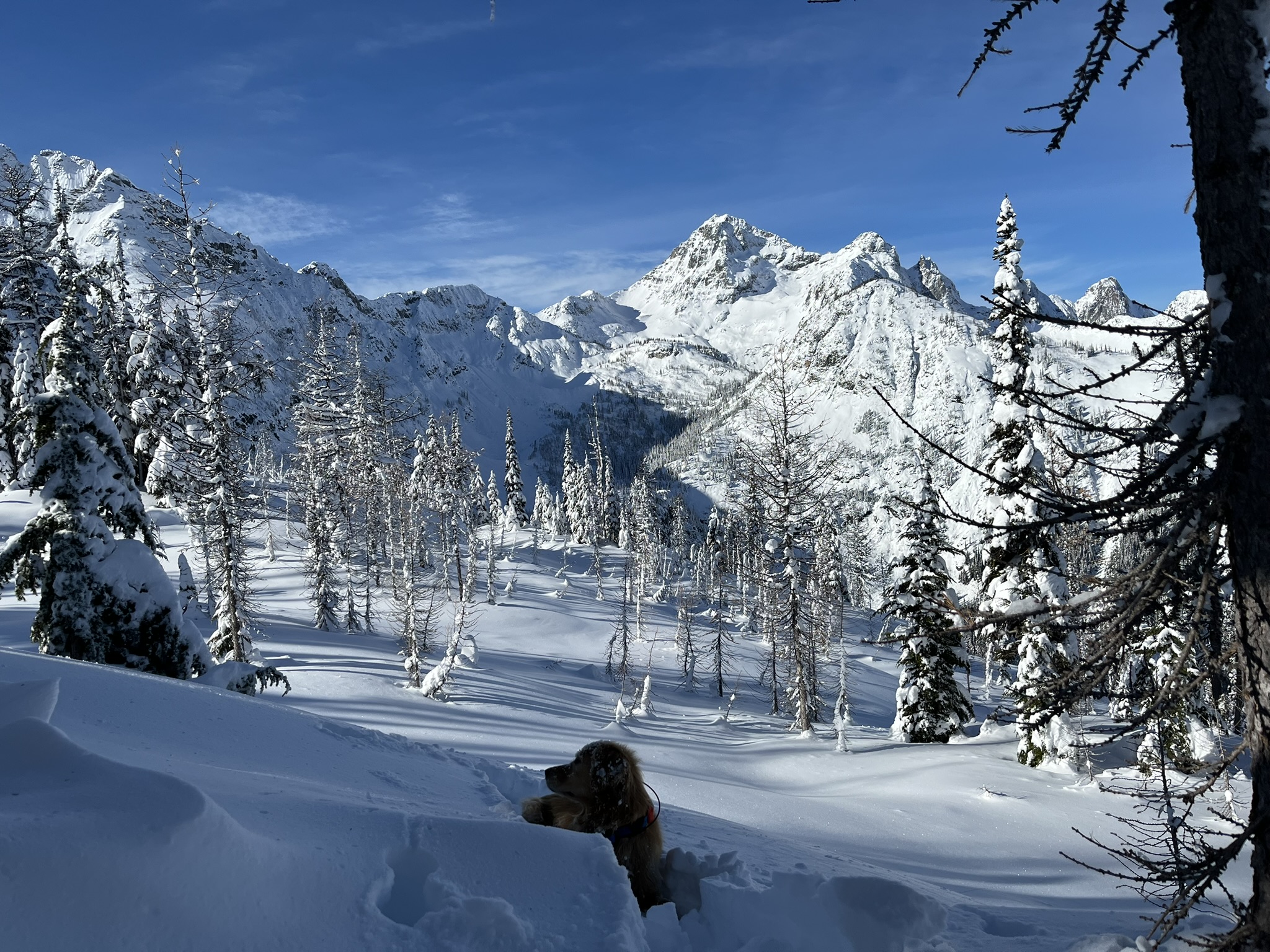
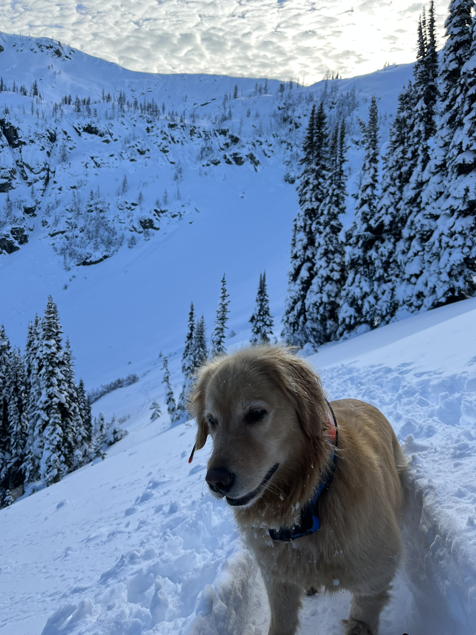
We started from Rainy Pass and skinned toward Heather Pass through subalpine larch. Their branches were bare and dark against the white — like charcoal sketches of trees. The larch were the only things up here that looked dead. Everything else looked deeply, aggressively alive under all that snow.
The clouds were higher this time. And thinning.
Reading the Terrain
From the pass we dropped into the Lake Ann drainage to check conditions. The snow was deep but unconsolidated, pillowing over every rock and stump. Much better than a week ago. The steep headwalls above the lake were loaded and waiting.
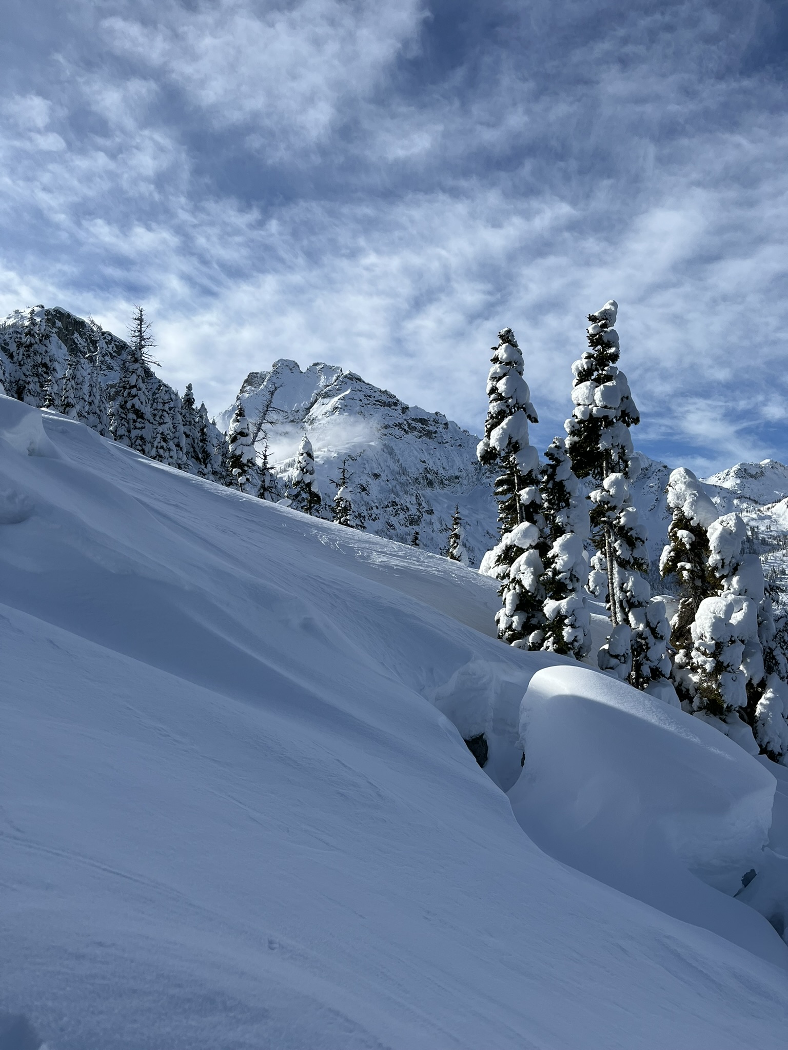
We climbed back up and continued along the ridge, gaining elevation through firm wind-packed snow. The terrain up here was open and rolling — broad bowls falling away on both sides, the ridgeline itself a clean highway of consolidated snow. I ran ahead, nose working the wind. Ptarmigan. Something musky — maybe marten. The usual November cast of characters.
The High Point
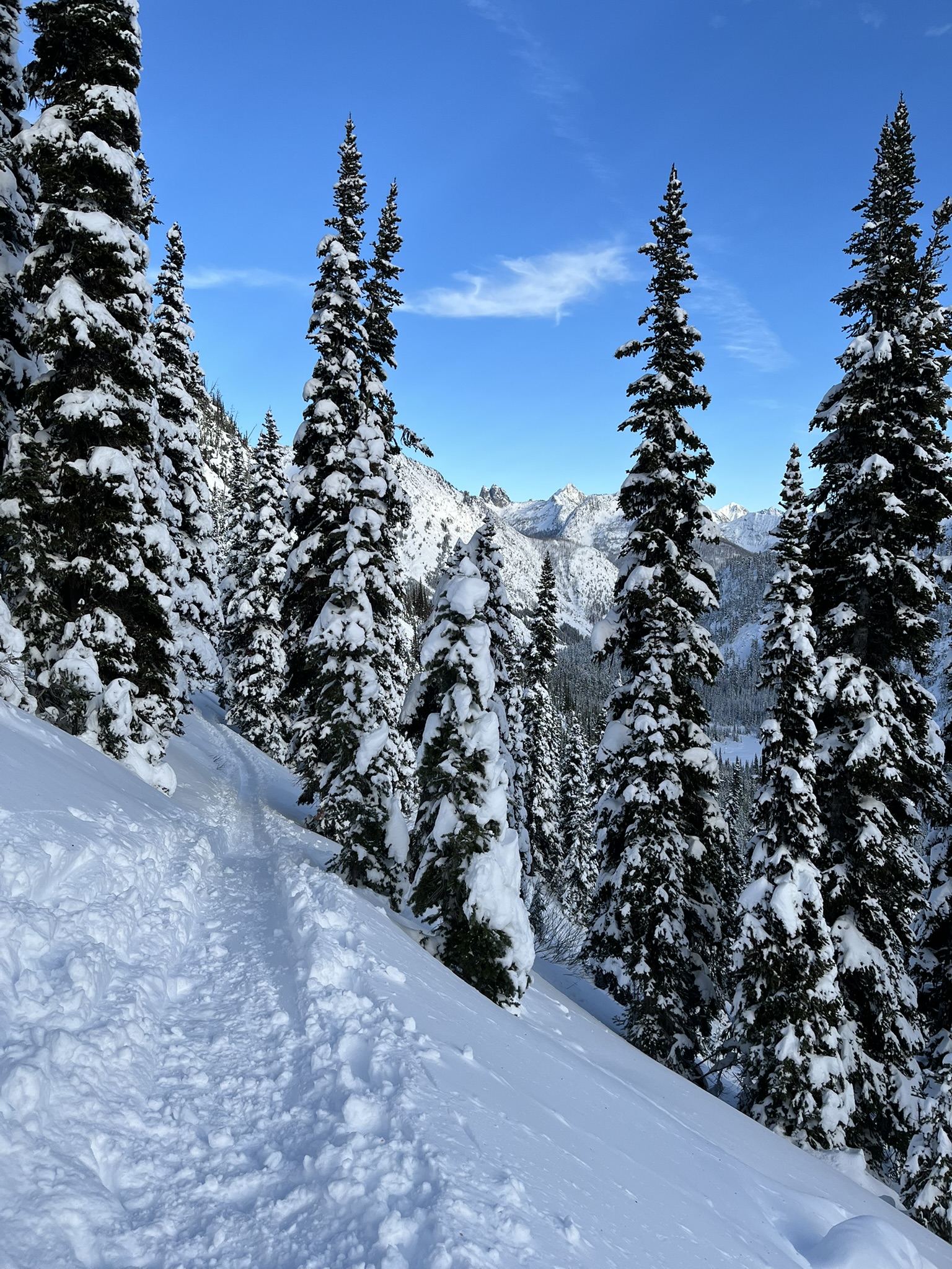
At 6,837 feet we reached the high point and the sky finally cooperated. The clouds burned off and the whole North Cascades snapped into focus — Corteo, Black, the Liberty Bell group, all of them plastered in white, sharp against a blue so deep it was almost violet.
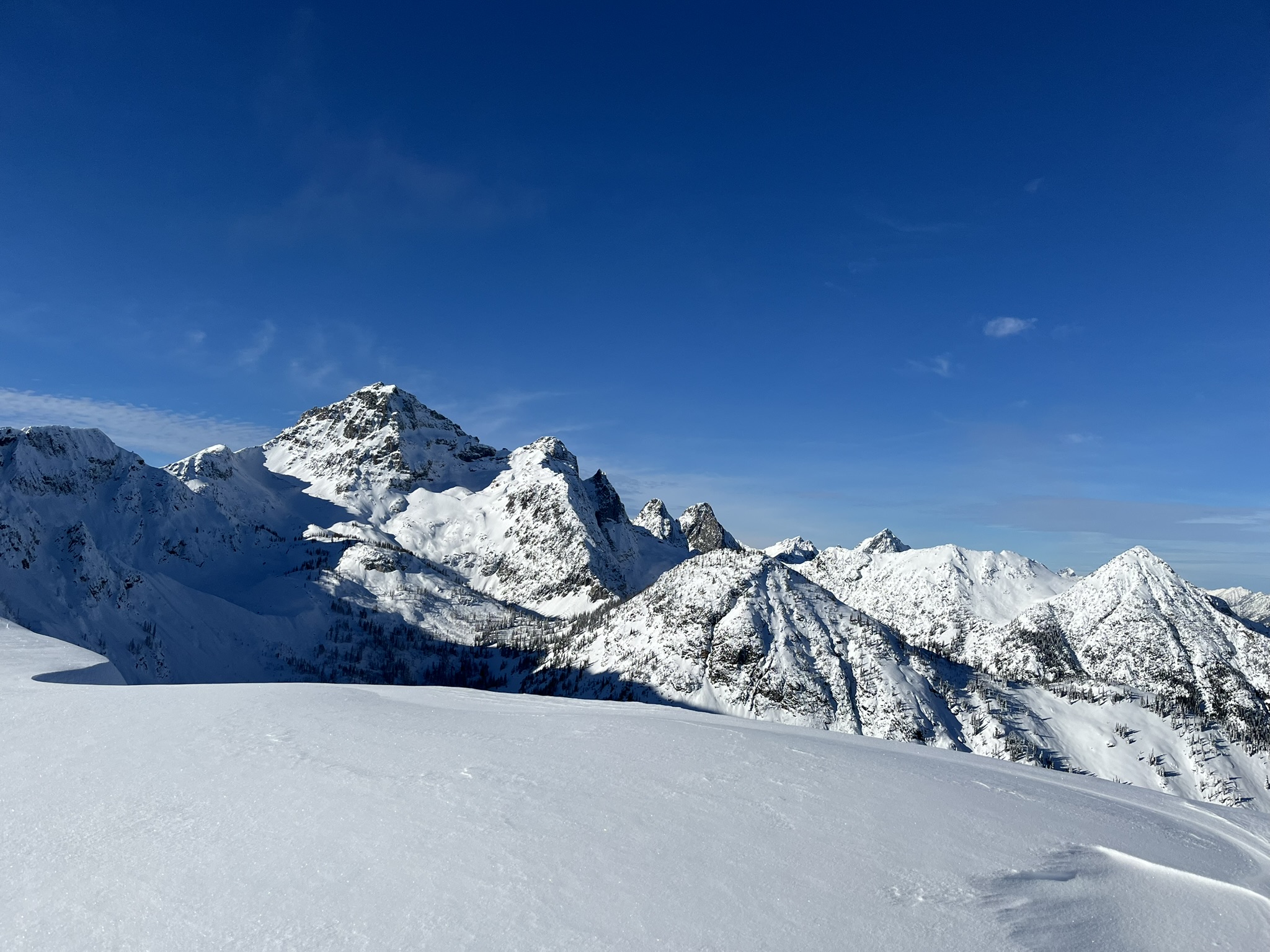
My human was mapping lines in his head. I could tell by how long he stared at each drainage. The south-facing bowls had good pitch and good runout. The steeper couloirs on the north side needed more snow but were filling fast. Three more storms and they'd be ready.
I found a stick. A tiny one, frozen and brittle, poking out of the snow at nearly 7,000 feet. I carried it for a while.
The Way Down
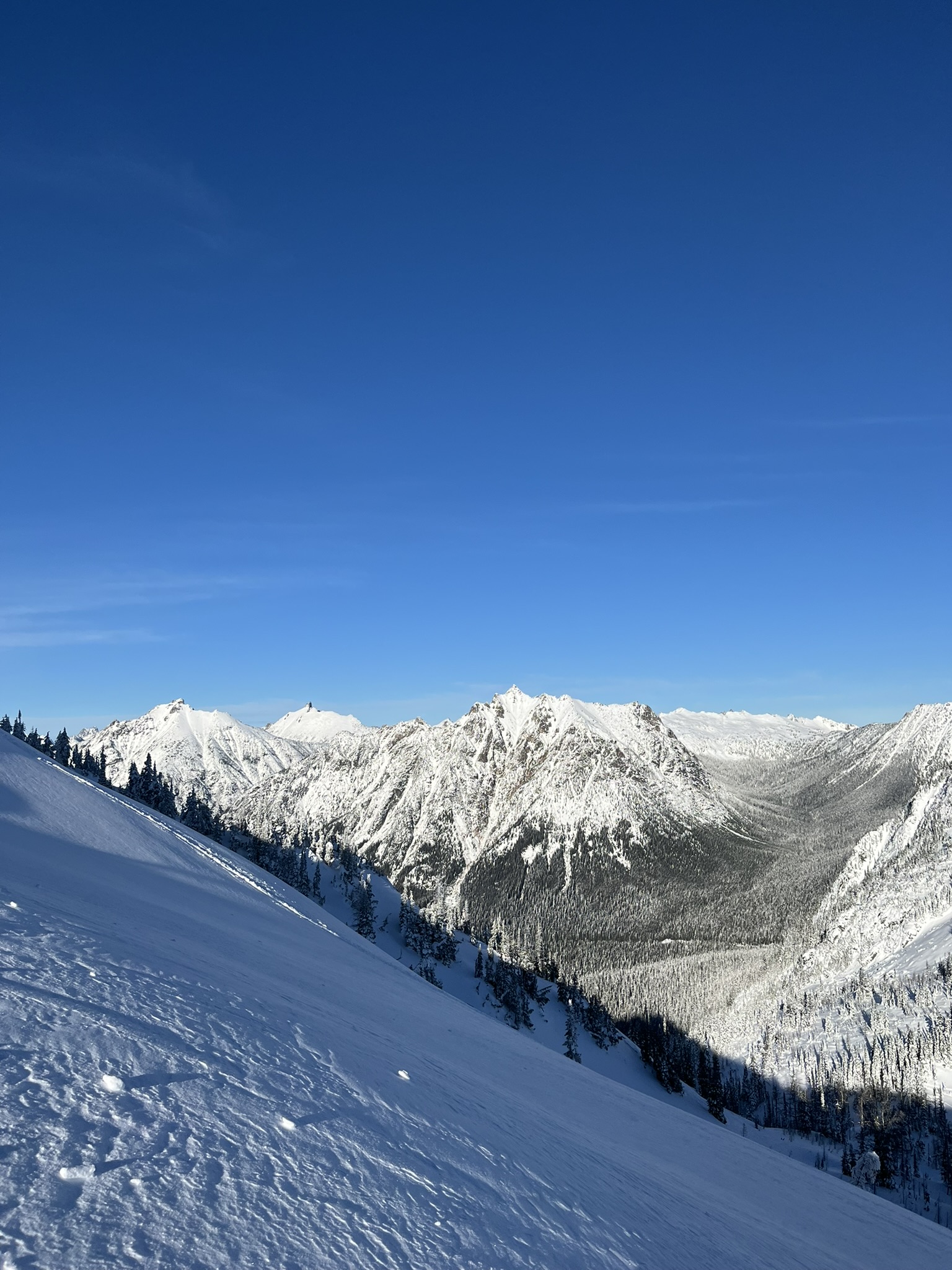
We descended the way we came — along the ridge, back through the pass, down through the larch. The afternoon had cleared completely and the light was gold on the upper peaks while the valleys were already in shadow.
We didn't ride anything on either of these trips. That wasn't the point. The point was to see where the snow was, where it wasn't, and where it would be when the next systems came through. On November 1st, the answer was: not enough, not yet. By November 8th, the answer had changed to: getting close.
The mountains were building. We'd be back with a plan.