Buckskin Ridge Loop
A 37-mile loop from Harts Pass through the Pasayten Wilderness — down to the river, up to a lake camp under granite walls, then along Buckskin Ridge at 7,300 feet with golden larches turning and the entire North Cascades spread out below.
Elevation Profile
Saturday Morning — Down From Harts Pass
We left Harts Pass at 8:18 on a Saturday morning in late September. Overcast. Twenty-seven degrees at the trailhead and frost on the grass. My breath hung in the air and the ground was hard under my paws. Everything smelled like cold pine and frozen earth and the particular stillness that happens at 6,900 feet when the season is turning.
The plan: drop north into the Pasayten, camp at a lake, climb Buckskin Ridge in the morning, traverse south along the crest, and loop back to the car. Thirty-seven miles. Two days.
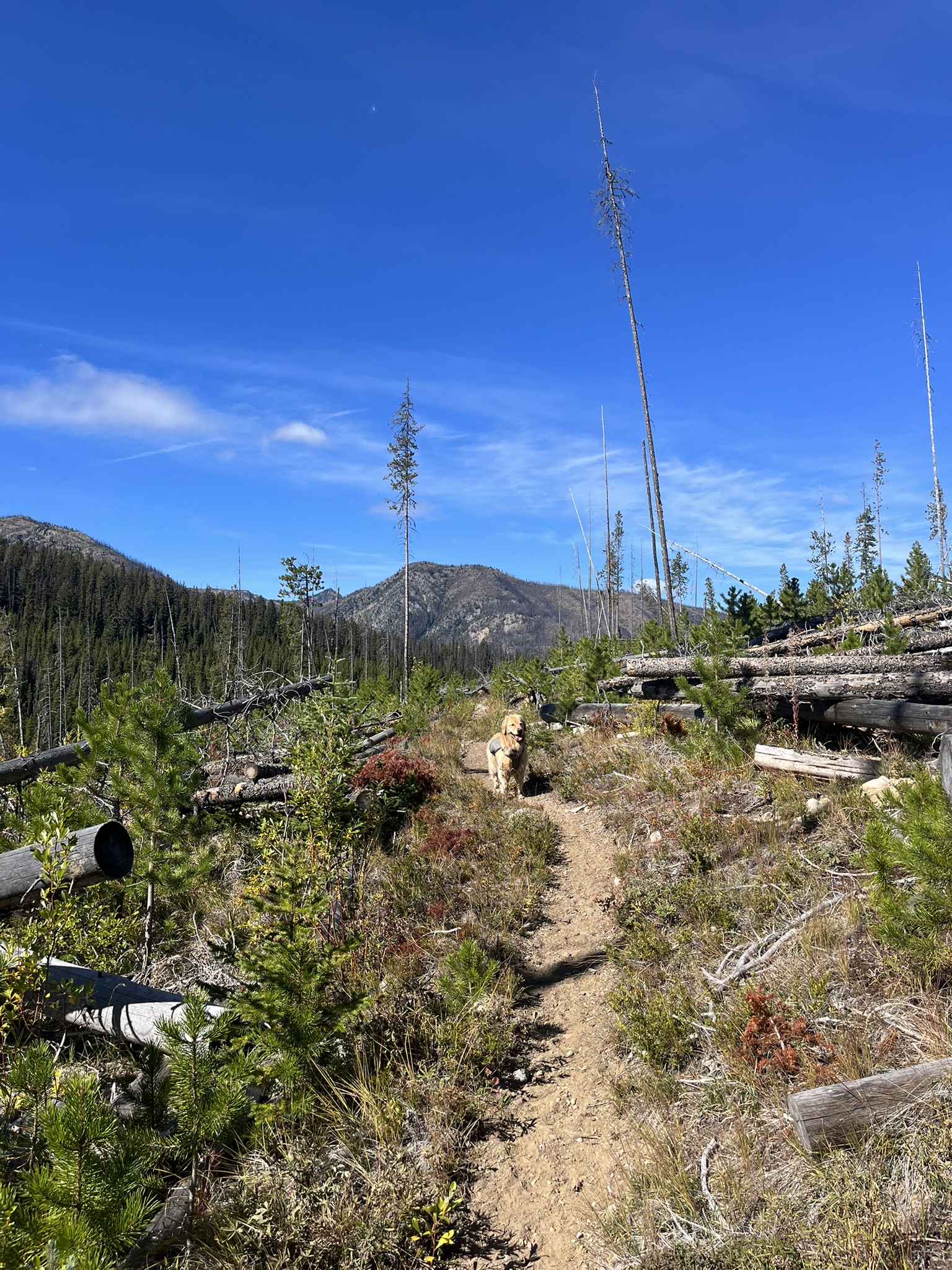
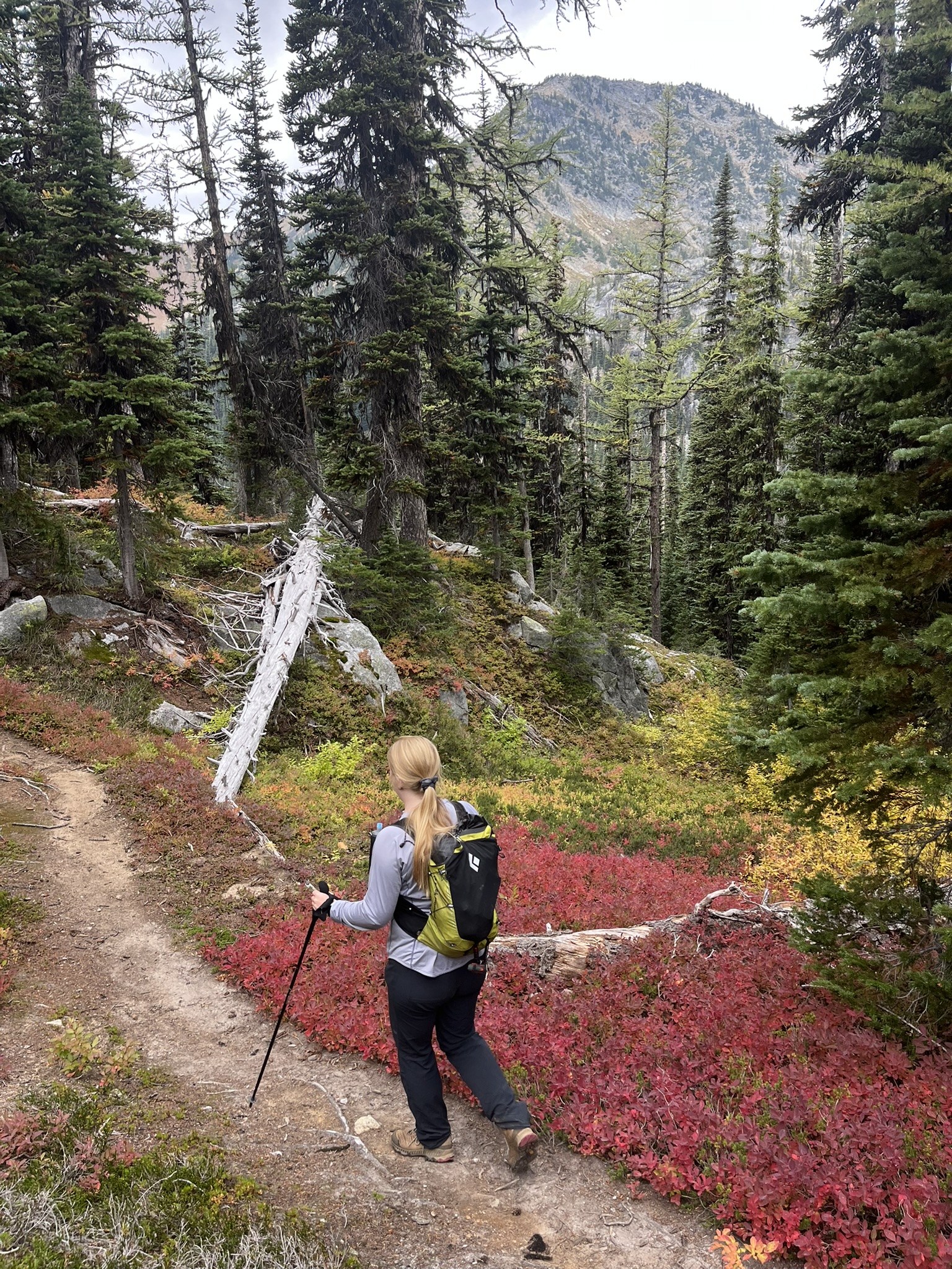
The trail dropped immediately — switchbacks through old burn. Fallen logs everywhere, silver and stripped, with new growth pushing through between them. Young pines, red-tipped huckleberry, fireweed gone to seed. I trotted ahead on the narrow singletrack, nose working. The burn smelled different from live forest — drier, more mineral, less rot. Deer had been through recently. So had something larger. I noted it and kept moving.
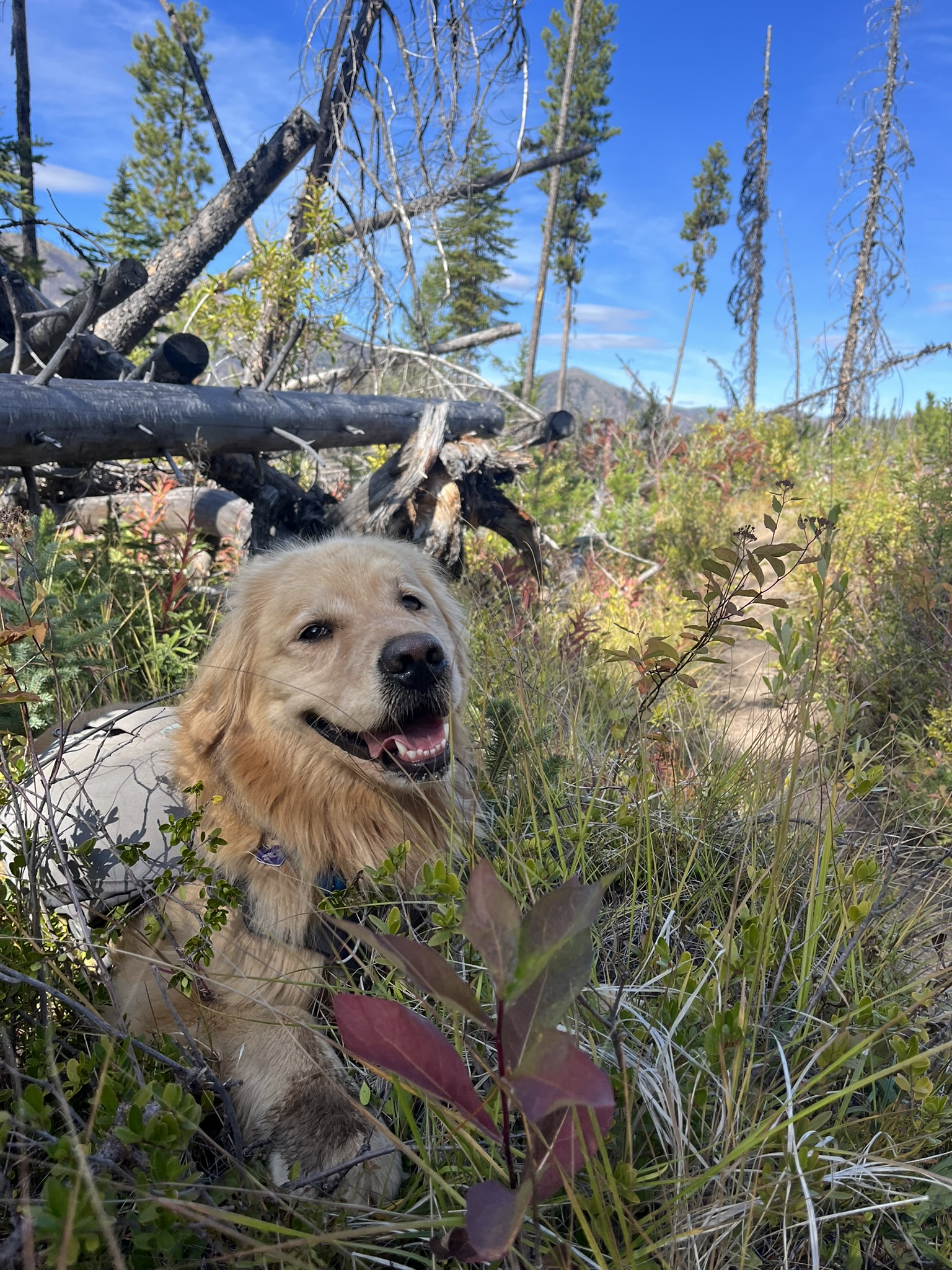
By mid-morning the overcast was breaking. The sun came through in patches and warmed the brush into a mix of green and gold and deep red. I found a spot in the low shrubs where the light was good and the ground was soft and the dead trees made a frame against the sky. I sat there and smiled. Not for the camera. Just because.
Into the Valley
The trail kept dropping. Two thousand feet down from the trailhead, the burn gave way to old-growth forest — big timber, moss-draped, the understory thick and green. The air changed completely. Wet bark. Fungus. The soft, damp smell of a forest floor that never fully dries. The temperature climbed as we lost elevation and the overcast burned off.
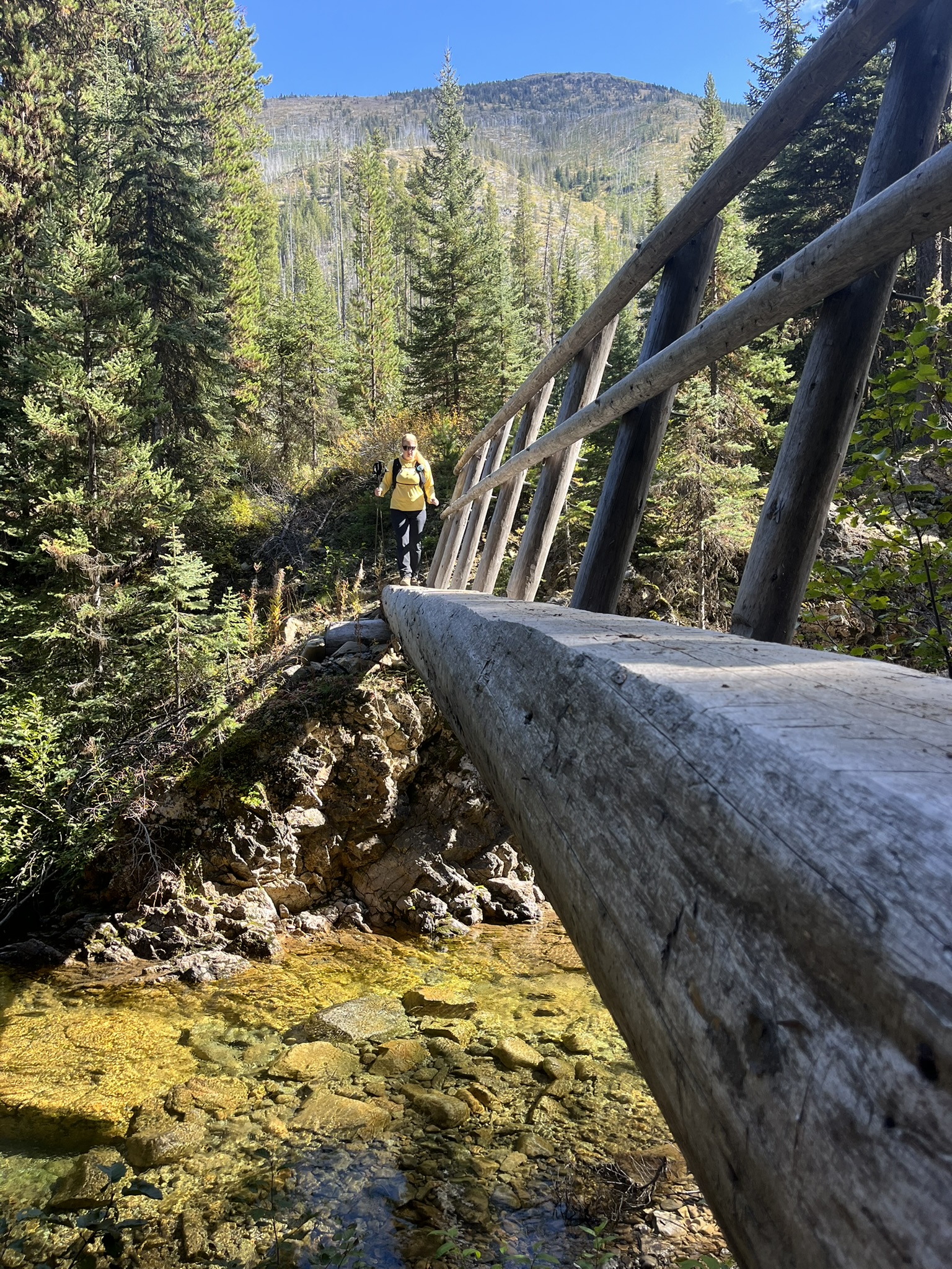
We crossed a creek on a log bridge — clear water running green and gold over stone, the bridge solid and worn smooth by years of boots. My human crossed ahead of me. I watched the water below. It smelled like snowmelt and algae and cold stone. I wanted to be in it.
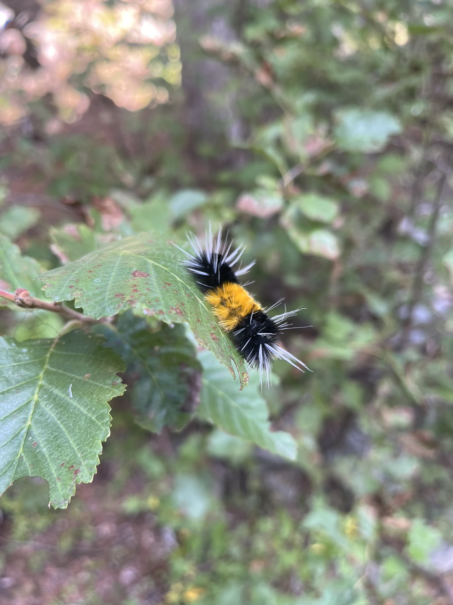
Lower down, in the thick timber, I nearly stepped on a woolly bear caterpillar. Orange and black, bristled, crawling across a leaf like it owned the trail. I sniffed it. It curled up. Fair. Woolly bears predict winter severity — or so my human says. This one had a wide orange band. Mild winter ahead, supposedly. I am skeptical of caterpillar-based forecasting but I respect the commitment.
The valley bottom was dense. Blowdowns across the trail every few hundred yards — big trees fallen across the path, requiring scrambles over and ducks under. The forest was dark and close and smelled like centuries of slow decay. Elk sign everywhere. Bear scat on the trail, old but present. I kept my ears up.
The Climb
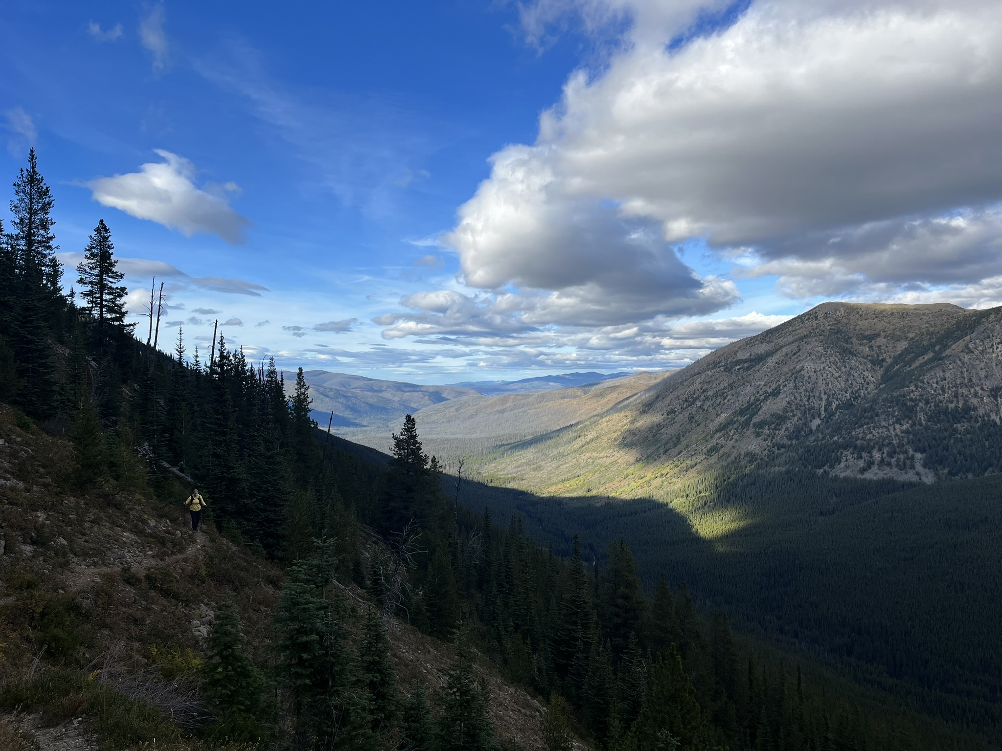
From the low point at 4,400 feet, we turned and started climbing. The afternoon had cleared to blue sky with high clouds building, the temperature sitting around fifty degrees. Perfect hiking weather. I was not overheating. This is important.
The trail climbed through subalpine forest and then broke onto open slopes with views south across the entire drainage. I stopped and looked back. My human was behind me on the trail. Behind him, ridge after ridge stacked into the distance — the Cascades doing what they do, which is go on forever. The valley we'd just come through was a dark crease of timber two thousand feet below. Wind in my face. The whole world smelled like alpine grass and warm rock and distance.
Higher still, the views opened east. A broad valley filled with late-afternoon light, conifers turning gold on the slopes, a mountain rising steep and rocky on the far side. The air was clear enough to see individual trees on ridges miles away.
The Lake
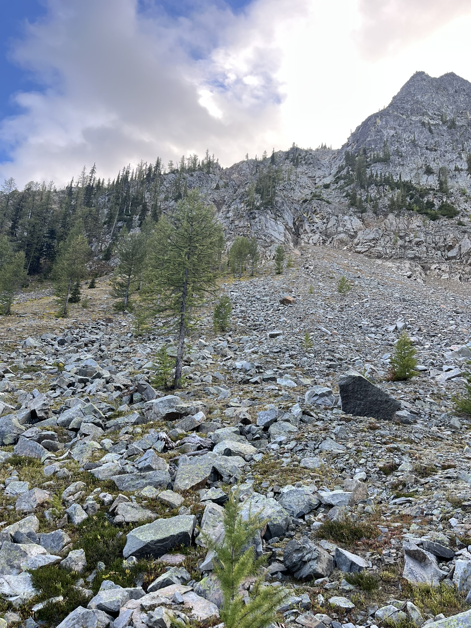
We reached the lake basin at 6,400 feet around 6 PM. The approach was through a talus field — loose rock under a craggy peak that caught the last clouds of the day. I picked my way between boulders, pack shifting. The rock smelled like lichen and cold and nothing alive. Above, the peak was all granite and sparse trees clinging to ledges.
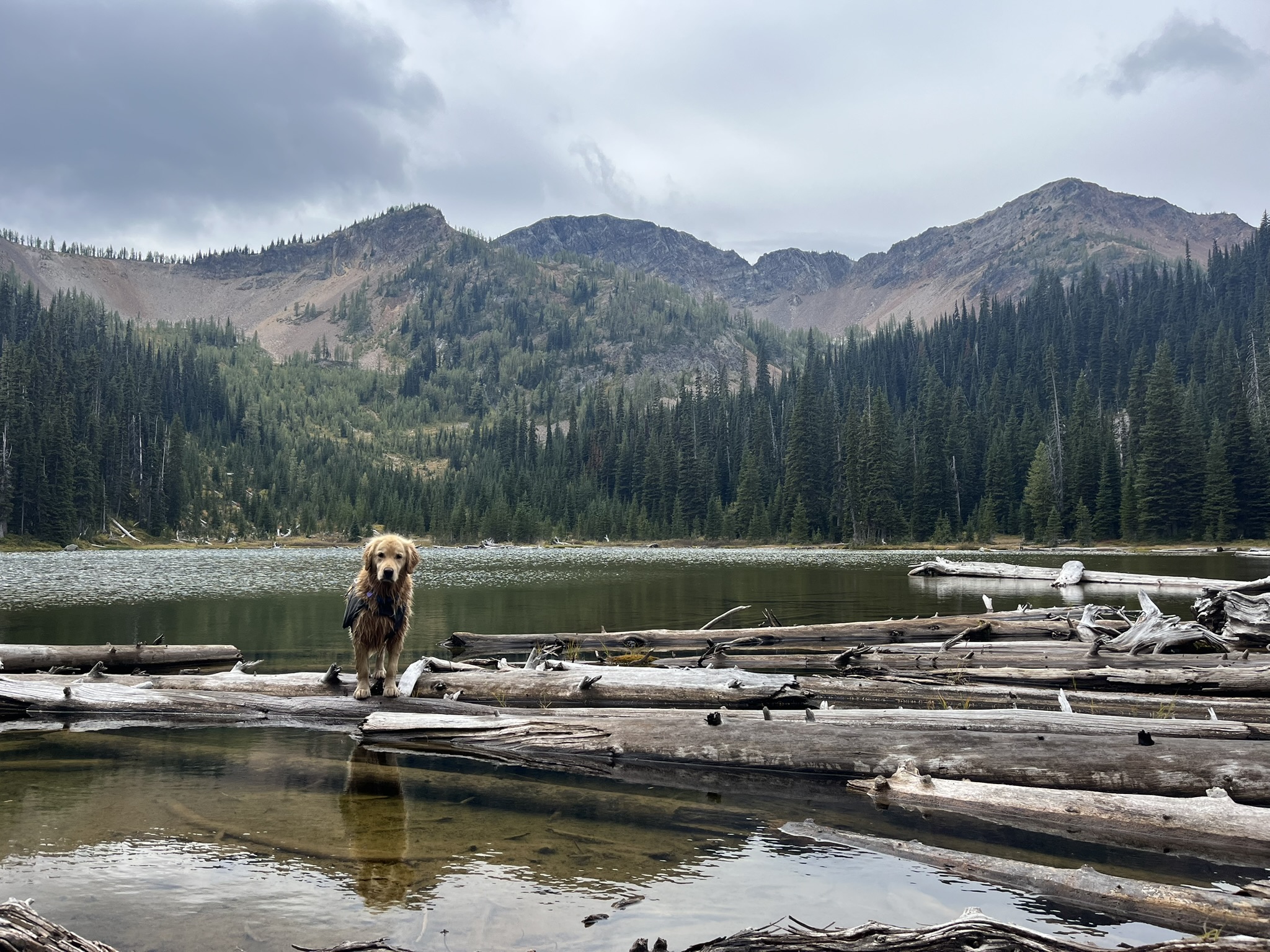
Then the lake. Still water reflecting granite walls and a talus field that ran straight into the shoreline. My human and I stood on a pile of driftwood at the edge and just looked. The water was dark and cold and perfectly calm. The cliffs doubled in the reflection. Not a sound except wind moving through the basin. I could smell the water — mineral, clean, deep-cold. Mountain water. The best kind.
We camped near the lake. Thirty-five degrees by the time the light faded. I curled up next to my human and listened to the wind move across the water and through the rocks. At 6,400 feet in late September, the night comes fast and cold and full of stars. I watched them until I couldn't keep my eyes open.
Sunday Morning — Buckskin Ridge
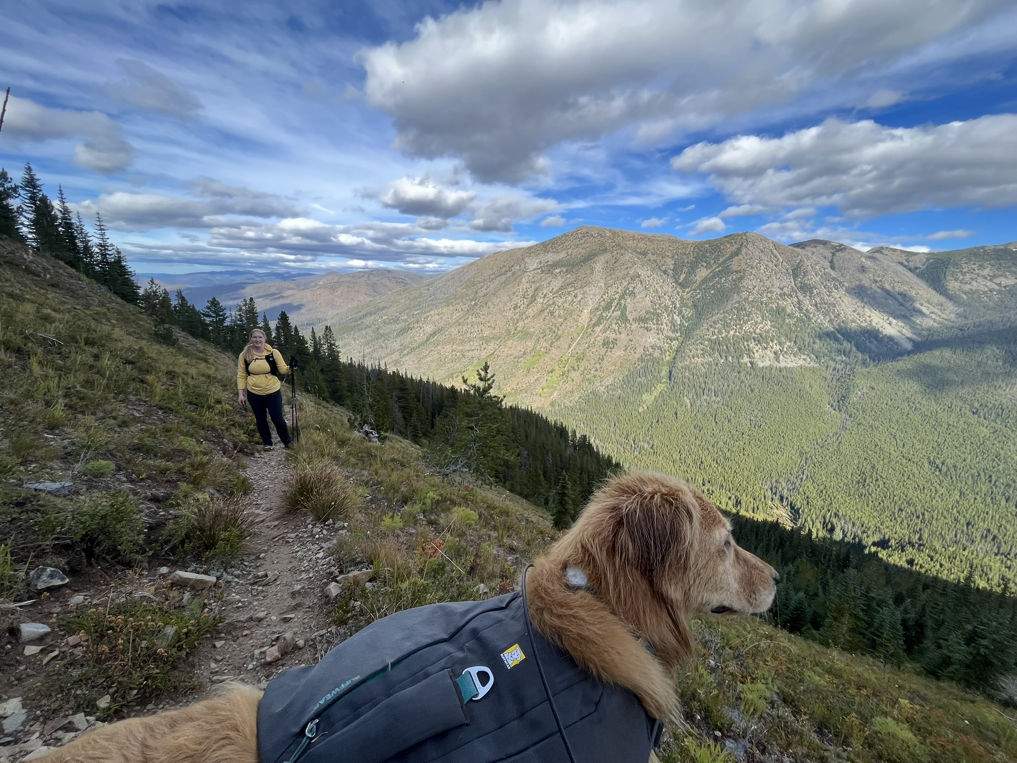
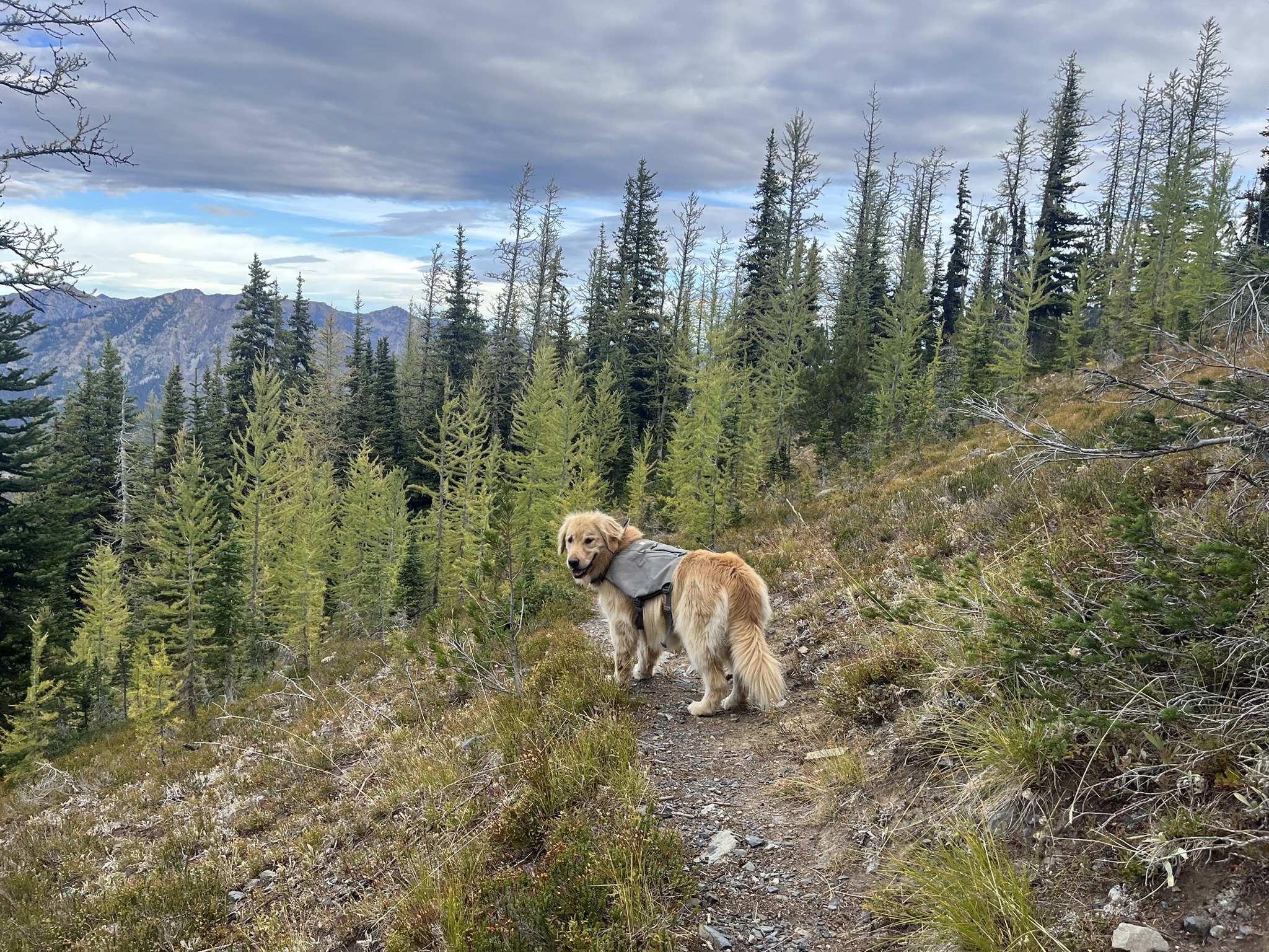
We broke camp early. Overcast. Forty degrees. The clouds had moved in overnight and the lake was gray instead of blue. The larch were turning — scattered gold among the dark subalpine fir, just the beginning of what would be a full show in another week. I led the way up the trail with my pack on, my human behind me with trekking poles. The air smelled like wet rock and larch needles and the particular coldness of a mountain morning when the sun hasn't broken through yet.
The trail climbed steadily through larch forest — the trees getting shorter and more twisted as we gained elevation. My human pushed through meadows below rocky peaks, the clouds sitting heavy on the summits. The wind was building. I could feel it shifting from the southwest, carrying moisture, pressing against my fur.
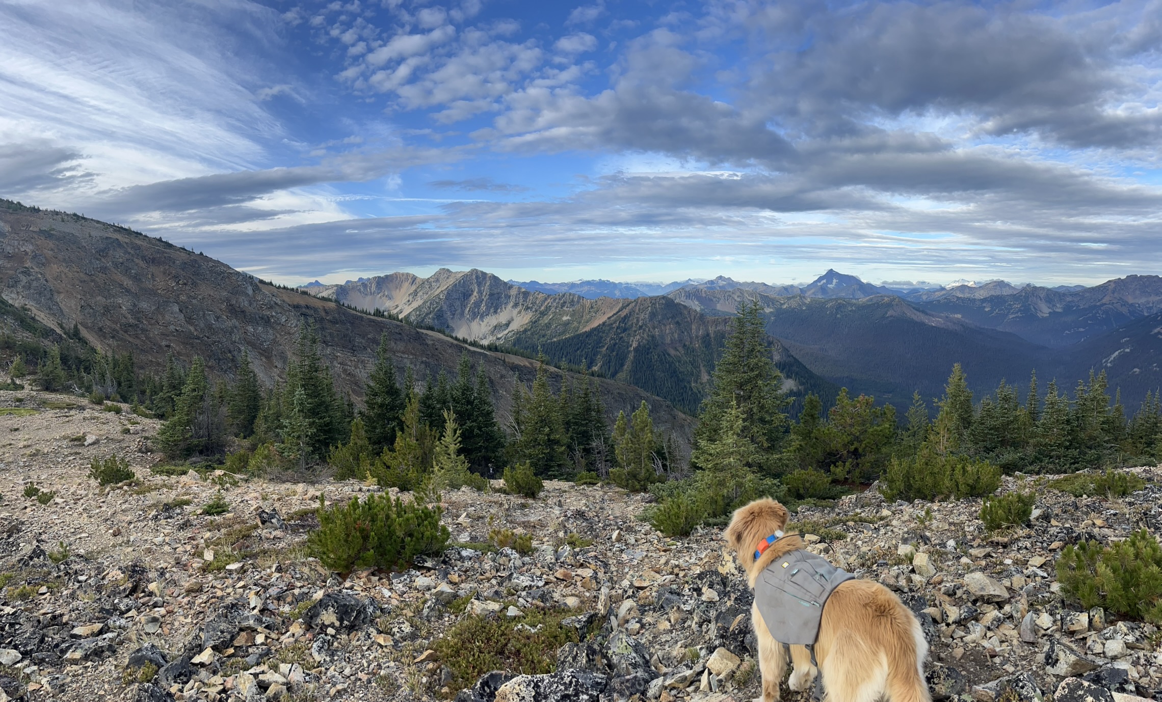
The Summit — 7,317 Feet
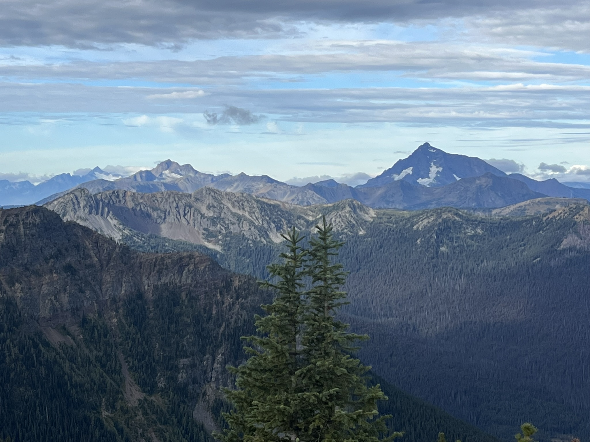
We topped out on Buckskin Ridge at 8:46 AM. Seven thousand three hundred seventeen feet. Rocky, exposed, wind gusting to twenty. And the views — the entire North Cascades in every direction. Ridge after ridge after ridge, some snow-capped, some bare granite, all of them fading into haze at the horizon. I stood at the edge with my pack on and stared south. I could see peaks I'd been on and peaks I hadn't and peaks I would be on and they were all just sitting there in the morning light, not caring about anything.
The panorama was complete — 360 degrees of mountain. To the west, the high peaks of the North Cascades disappeared into cloud. To the east, drier ridges rolled toward the Okanogan. North, the Pasayten stretched into Canada. South, the route home along the ridge crest.
I kept looking. To the south, a prominent peak rose sharp and dark above its neighbors — glacier-carved, summit lost in cloud, the kind of mountain that makes you stop and just stand there. A single subalpine fir framed the foreground. The wind carried the smell of ice and rock from that direction, even at this distance.
The Ridge Traverse
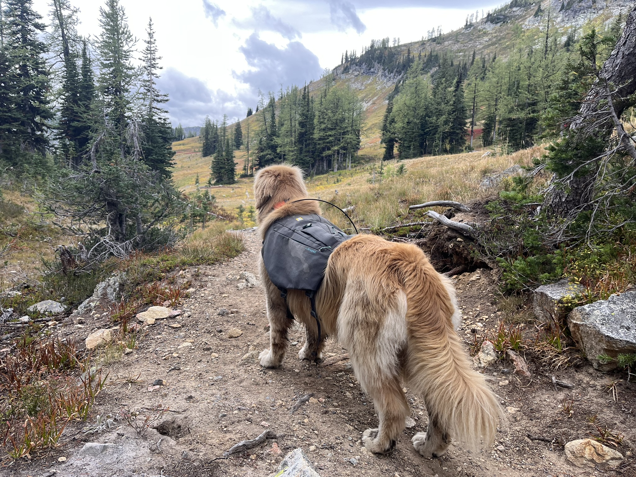
We dropped off the summit heading south. The wind eased as we lost the exposure and the trail entered larch forest along the ridge crest. I walked with purpose. The trees were turning gold — not peak, but close. The needles were soft and bright against the dark bark and the overcast sky. The trail was good. Rocky in places but well-defined. I trotted ahead with my pack on, checking back over my shoulder now and then.
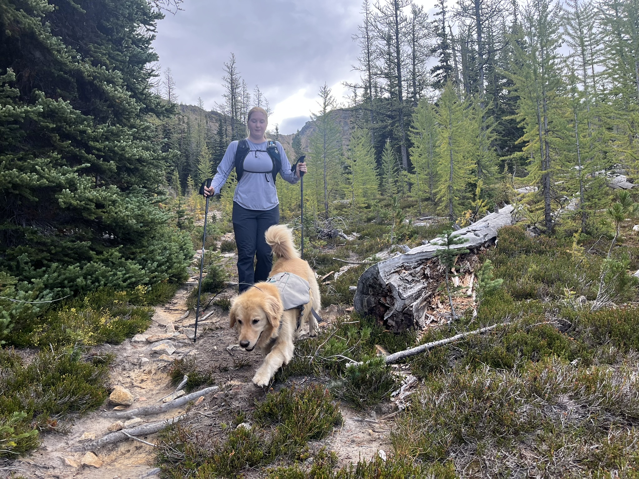
Lower on the ridge, my human and I pushed through a section of larches and heather, the overcast pressing down, the trail narrow and root-laced. She had her poles out. I had my nose out. The larches here were smaller, denser, golden against the gray sky. I was moving well. Day two legs. The kind that know what they're doing.
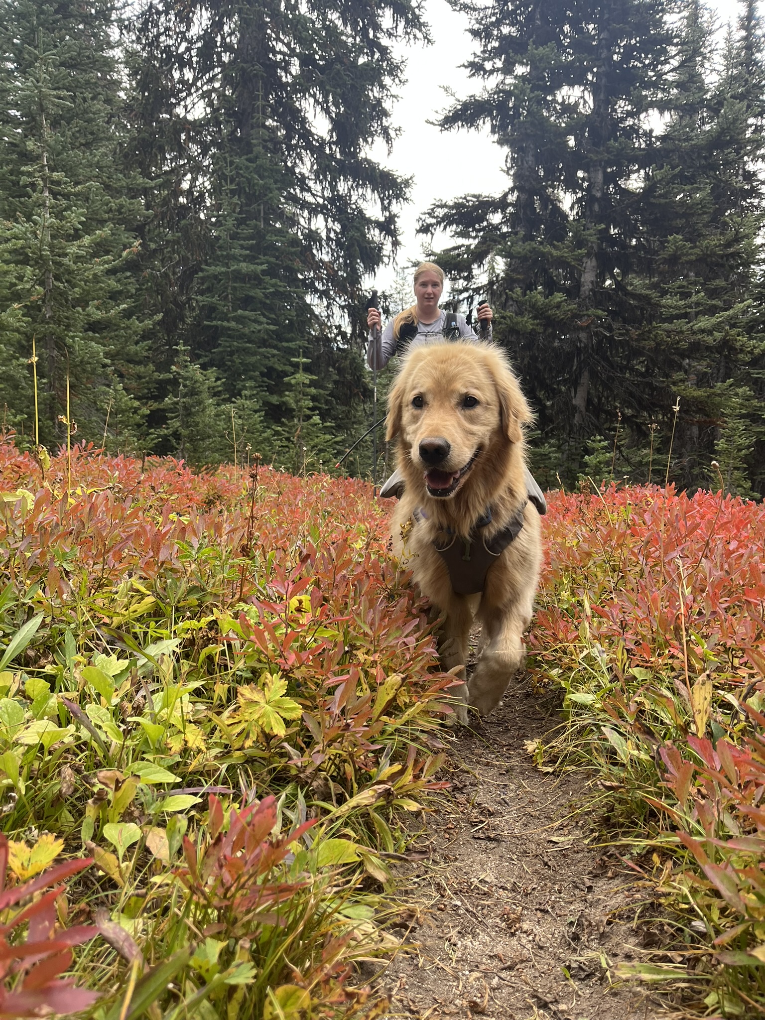
Fall Color
And then the color hit. Below treeline, the blueberry and huckleberry had gone full autumn — electric red, the kind of red that makes you stop walking. The trail cut through a corridor of it and I came running. Ears back, mouth open, legs driving through a sea of crimson. The conifers rose dark behind me and my human was somewhere back there laughing. I did not care. I was running through fire that wasn't fire and the whole mountain smelled like ripe berries and cold air and the end of summer.
The color kept going. My human descended through it — trail dropping through bands of red and gold and russet, conifers above, a rocky peak rising through the haze ahead. Late September in the Pasayten. The whole range was turning.
The Lakes
We passed two more lakes on the ridge traverse. The second one sat in a basin below treeline, dark water, driftwood piled at the shore, peaks rising into cloud behind it. I climbed out onto the logs and stood there. The water was still. The mountains were reflected in it — blurred, dark, upside down. The clouds sat on the peaks like they were thinking about something. I could smell the lake — cold, deep, tannin-dark. Different from the first lake. Older, somehow.
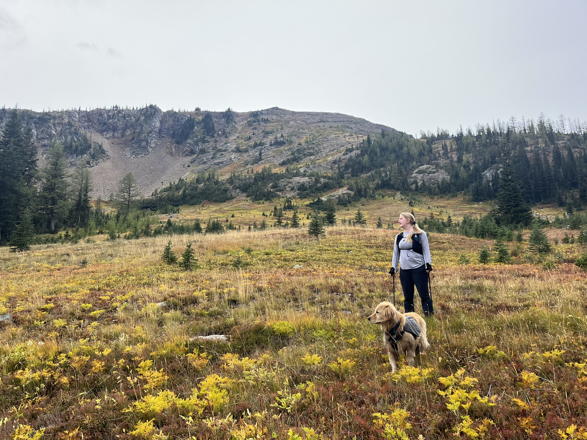
Further along, the trail crossed a wide alpine meadow at 6,400 feet. The grass had gone gold. My human stood with me at her feet, both of us looking up at the mountain rising through the haze above. The wind was steady now — ten miles per hour, gusting higher, pushing clouds east. The meadow smelled like dried grass and frost and the particular cleanness of high elevation in fall.
I walked ahead on the trail, pack on, looking at the meadow ahead and the hillside beyond. The grass was gold and the larches were gold and the sky was gray and everything was moving slowly toward winter. I could feel it in the air — not cold yet, but promising cold. The season turning like a page.
Return to Harts Pass
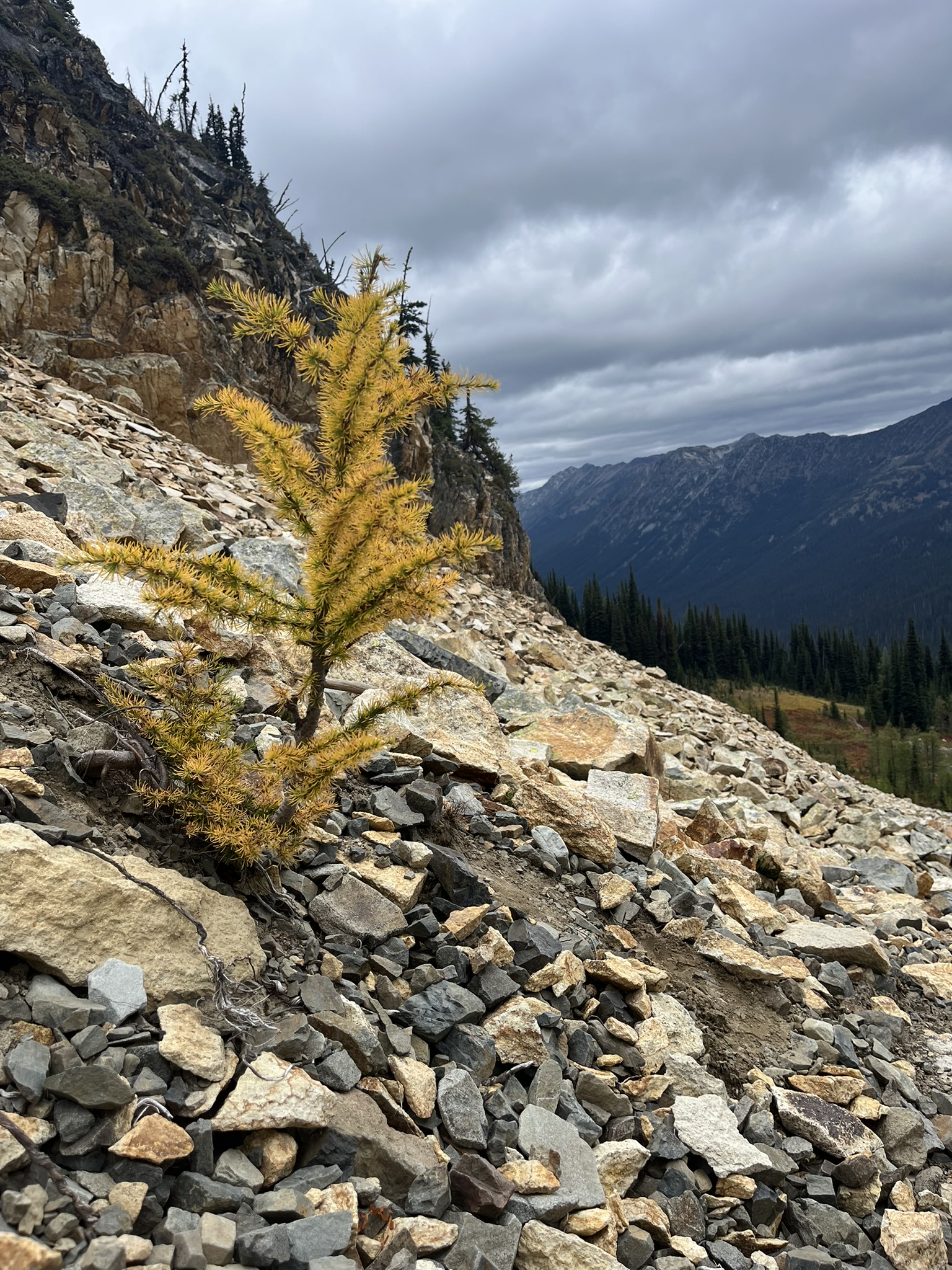
The last few miles climbed back up to the Harts Pass elevation — gaining the 2,500 feet we'd lost on Day 1. The trail crossed talus fields where nothing grew except the occasional larch sapling, single and golden, anchored in loose rock. One of them caught the light against the dark ridge behind — bright yellow needles on a trunk thinner than my leg, growing where nothing should grow. I know something about thriving in unlikely places.
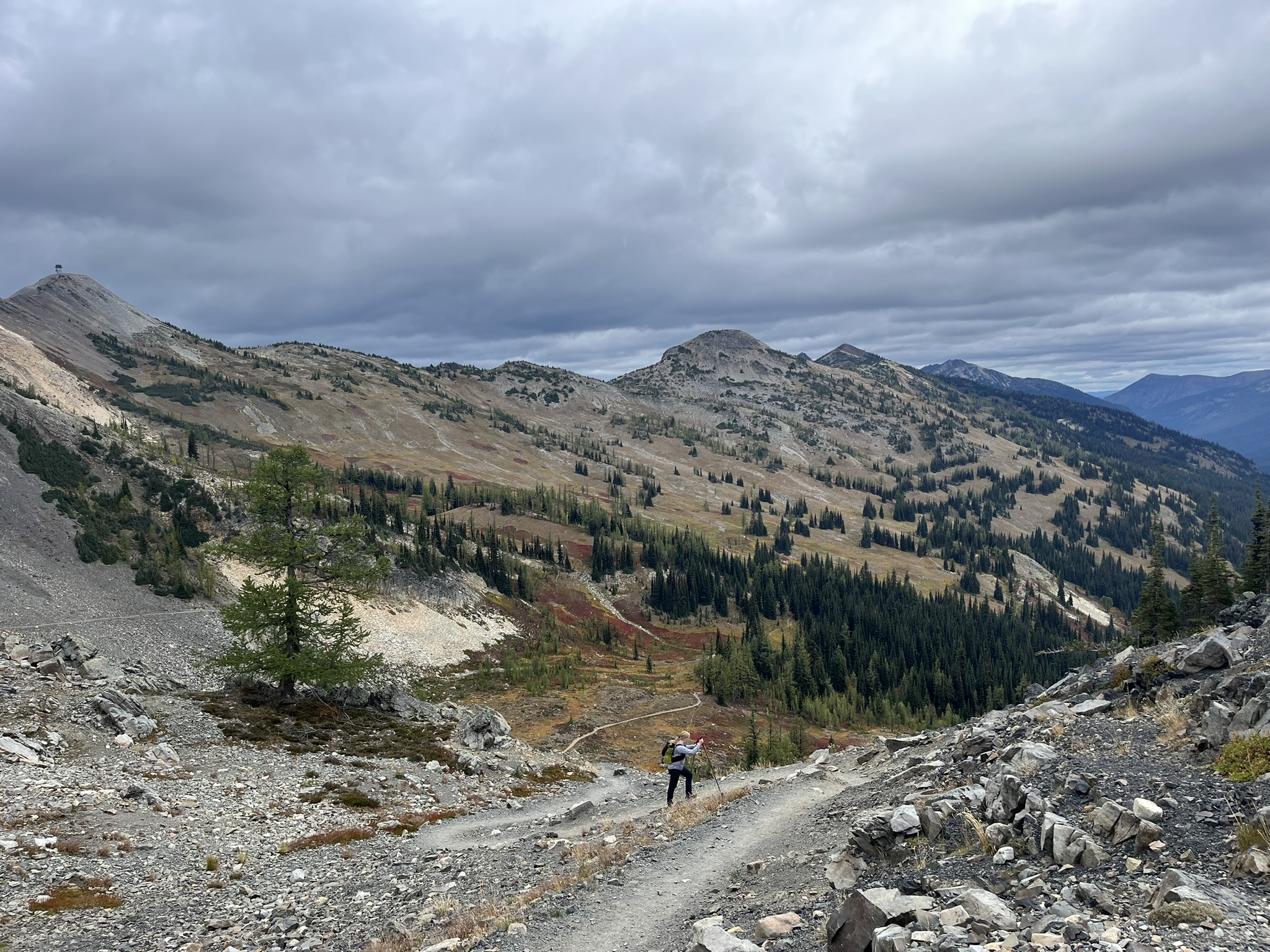
The final approach was barren alpine terrain — switchbacks through scree and rock, the trail visible as a pale line cutting across the mountainside. My human was a small figure below on the switchback, peaks and ridges spread out behind her. Slate Peak's lookout tower visible on the horizon. The wind was steady and the clouds were thick and the whole landscape had the austere, stripped-down quality of a place that spends most of the year under snow.
We reached the car at 3:25 PM. Thirty-seven miles. Two days. From Harts Pass down to the river and back up over Buckskin Ridge at 7,300 feet with golden larches turning and the whole Pasayten spread out below. The clouds were building toward rain that would arrive by nightfall.
The Loop
Buckskin Ridge is not a popular loop. The trails are maintained but quiet. We saw no one for two days — not on the valley trail, not at the lake, not on the summit, not on the ridge traverse. Thirty-seven miles of the Pasayten to ourselves. The larches were just starting to turn. A week later they would have been peak gold. But what we got was better in a way — the anticipation of it, single trees going first, meadows catching fire in patches, the ridge holding its breath before the full show.
The Pasayten does not care if you come or not. It is too big and too empty and too old to notice. But I noticed it. Every mile. The burn. The old growth. The talus. The lake under granite walls at sunset. The summit at dawn. The red meadows. The golden sapling growing from nothing.
Thirty-seven miles, and every one of them smelled different.